Bike Ride
Coyote Creek Trail
Silicon Valley Blvd to Morgan Hill
Itinerary
Normally we would start a bit later and possibly visit other optional destinations while in Morgan Hill, but on Sunday 4/17 we need to be back at the car earlier for Hubby to make it on time to another event afterwards, so we want to start earlier and just eat lunch before biking back. We plan to hang out at the E's family's house afterwards and let the kids play together while Hubby goes to his event nearby.
| Time | Description |
| 9:00am | Meet at the Coyote Creek Trail Head off of Silicon Valley Blvd |
| 9:30am | Latest time to start biking |
| 11:00am | Arrive in Morgan Hill |
| 11:00am-12:30pm | Eat lunch |
| 12:30pm | Latest time to start biking back |
| 2:00pm | Arrive back at Coyote Creek Trail Head off of Silicon Valley Blvd |
| 2:30pm | Latest time to leave from Coyote Creek Trail Head for the E's family's place. |
| 3:00pm - ? | Hang out at the E's family's place. |
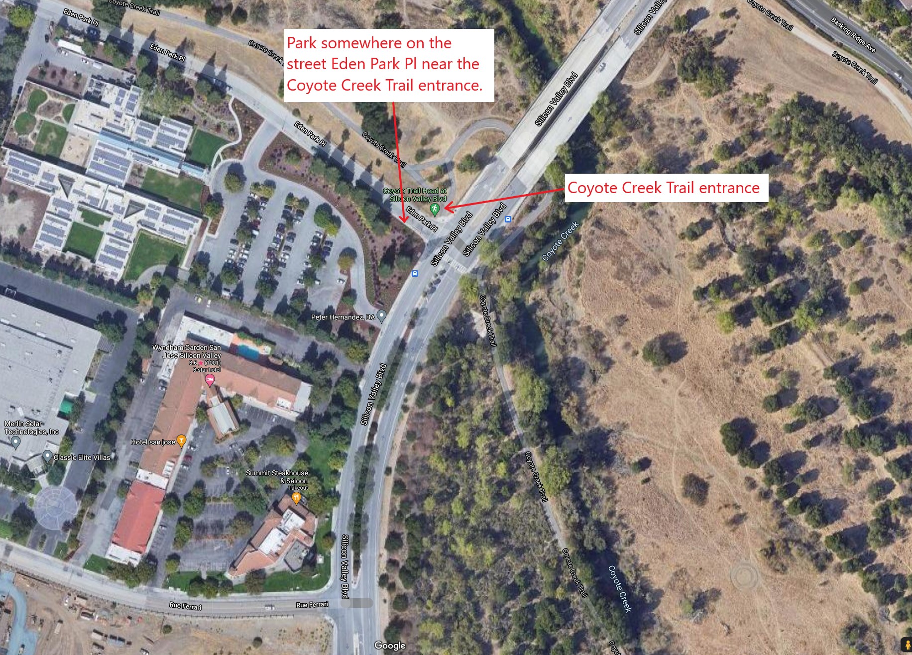
Meeting Location
Park on the street (Eden Park Pl) across from the Silicon Valley Blvd Coyote Creek Trail Head.
Use the following address and link to navigate via Google Maps:
Coyote Creek Trail Head at Silicon Valley Blvd, San Jose, CA 95138Picture showing the Coyote Creek Trail Head meeting place:
Biking Route
This biking route starts out at the Coyote Creek Trail Head on Silicon Valley Blvd.
On Coyote Creek Trail, it's a pretty flat and nice relaxing ride. It doesn't have much shade, though. When we biked it in the winter, it was beautiful, sunny yet cool, with nice green grass and bushes. Most likely in the summer it'd be a hot and dry ride.
Coyote Creek Trail ends in Morgan Hill, close to Cochrane. From there, we can bike to various different restaurants for lunch. Check out the list of restaurants further below.
After lunch, if there's time we can do some other optional stops. Check out the list of optional destinations further below.
Given that there are multiple restaurant options in Morgan Hill and multiple optional destinations, I did not map a round trip route for every single possibility. Instead, I mapped a Google Maps route from the meeting location to Coyote Creek Visitor Center, right before the Coyote Creek Trail ends. After that, use the Google Maps links for the various lunch options or optional destinations in below sections to navigate.
- Google Maps: Coyote Creek Trail Head at Silicon Valley Blvd to Coyote Creek Visitor Center at Anderson Lake
- MapMyFitness: Bike Route (RT) Coyote Creek Trail Head at Silicon Valley Blvd to Morgan Hill (MOD Pizza)